
Flooding Rains Move In
A cut-off low will bring heavy rain, cold air and even a little snow to the Carolinas today through Tuesday. The biggest threat by far is flooding in the mountains and foothills. While snow will fall to our west we’ll be in the deep moisture on the east side of the low caused torrential rains.
This combined with the higher terrain and quick run off will lead to flash flooding tonight and Tuesday.
The rain will change to snow at the tail end of the event above 3000’ with accumulations of 1-3” likely. This will be a wet heavy snow and only accumulate on grassy surfaces.

Rainfall Forecast from HPC:

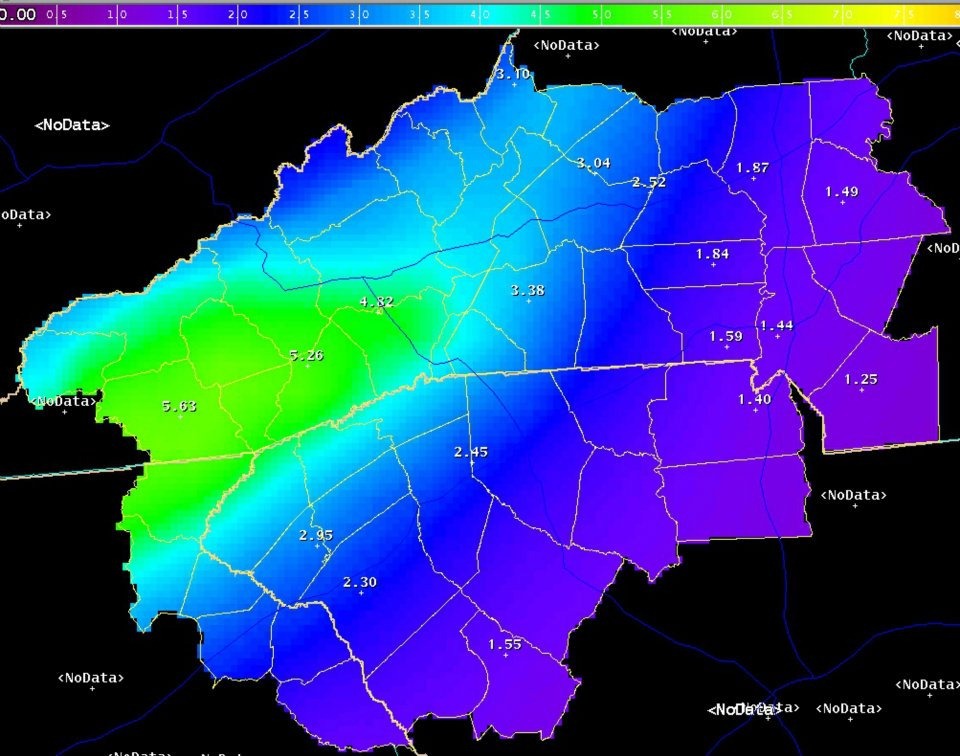
Rainfall Forecast from GSP NWSFO:

Snowfall Potential tonight:

You can download our Charlotte Weather App and stay up to date on the changing weather from your smartphone. Just scan the QR code below to download the app for FREE!


