
Weekend Storm Update: Mountain Snow & Piedmont Rain
The weekend storm is going to be good one just not wintry for everyone. This is going to be a big wind and rain maker for the piedmont but a potentially good snow storm for the mountains and up into the Mid-Atlantic. Not bad considering it’s Presidents Day weekend and lots of skiers will be in the mountains ready for snow. This might be the biggest east coast storm of the winter so far, if you discount that freak October snow last year. Here’s a look at some of the potential snowfall and rain totals in the Carolinas.
Chance for Snow:
Probabilities of 4” or more from HPC/NOAA

Analog chances of 2” or more based on similar storm set-up over history.

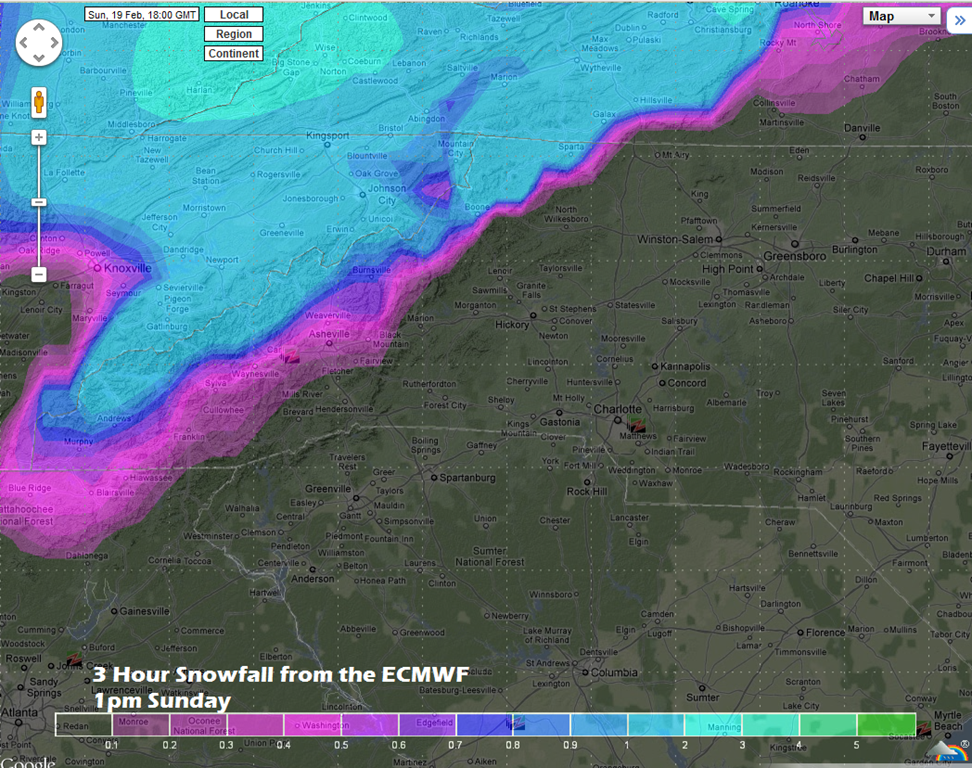
Model Snowfall from the ECMWF model:
This will be a wet heavy snow and areas above 3500’ will see the most. Down in the valleys this could be more of a rain snow mix. Worried this wet heavy snow could cause some tree issues something to watch for sure. Ashe and Watauga counties will see the brunt of this snow in NC. This is only one model but it has had the best handle on the storm so far.


Rainfall Forecast:
This is going to be a real soaker from the piedmont 1-2” a good bet. There also will be some very gusty winds in the 20-30 mph ranges likely with the nor’easter cranking up on the coast.


