

Heavy rain threat Saturday with some isolated severe storms
Maybe 4 days in a row with perfect weather was just too much to ask for. Now the rain is moving back in and it’s really going to be a soaker Saturday. As ugly as it will be at times Saturday the cool wet weather, for the most part, should save us from severe storms. That is until late in the day as a warm front tries to move north.
Futurecast:

Severe Weather Outlook for Saturday:


Set-up and ingredients:
The setup is one of the good old Carolina wedge days initially keeping us all stable. With high pressure to the northeast pumping cool dry air down and trapping it against the mountains. All day warm moist air will be riding up and over the wedge creating low clouds and rain. By evening though the warm front starts to move back north. This is where things could get a little interesting.
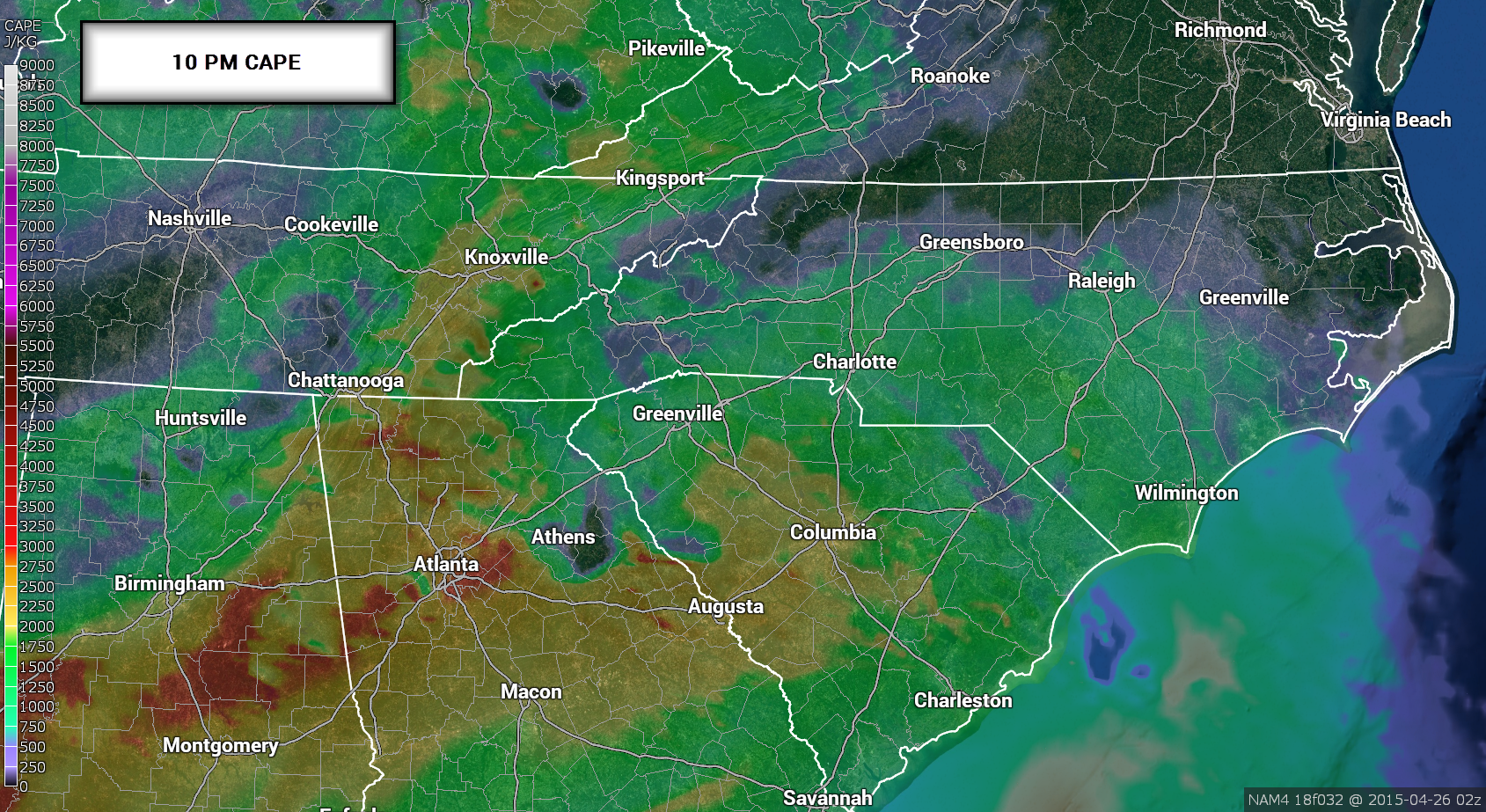
CAPE values go from nothing to something in a hurry as the warm front starts moving north around 6-8pm.
8-10pm CAPE or thunderstorm fuel:


Wind SHEAR or winds changing direction and speed with height:
Then we have a ton of shear or Storm Relative Helicity. This is what can cause storms to rotate, but you also need CAPE. You always have a ton of shear with wedge setups. Which makes sense since you have northeast winds at the surface and usually southwest winds at 5-10,ooo’. So we look for areas where the shear and CAPE overlap. Check out South Carolina!

Radar around this same time:

Low level jet and a warm front!


SUMMARY:
So rain will be heavy at times early but likely no major severe weather until the evening. This is when we have enough ingredients in place for some strong to severe storms around the North Carolina and South Carolina state line. Just another reason to stay weather aware Sunday especially if you live in South Carolina.


