
Weekend Winter Storm Potential but details still very uncertain.
Things are coming together for a potential winter storm somewhere on the east coast. There are still huge questions about track, intensity and type of storm this could be. The storm is currently over the Pacific ocean, so it is not being sampled by any upper air station. Thus, the models are not going to have a really good handle on the situation until tomorrow night or early Wednesday.
WPC Winter Storm Outlook:
The potential is there, and the WPC outlook shows the area very well right now:

GFS Ensembles:
Here’s a look at all the ensemble members. Basically, this is all the various simulations done by this model. The last panel is the key one to look at. That is the mean or the average of all the runs. So this helps to take out all the outliers and focus on what is likely to happen, versus what could happen.

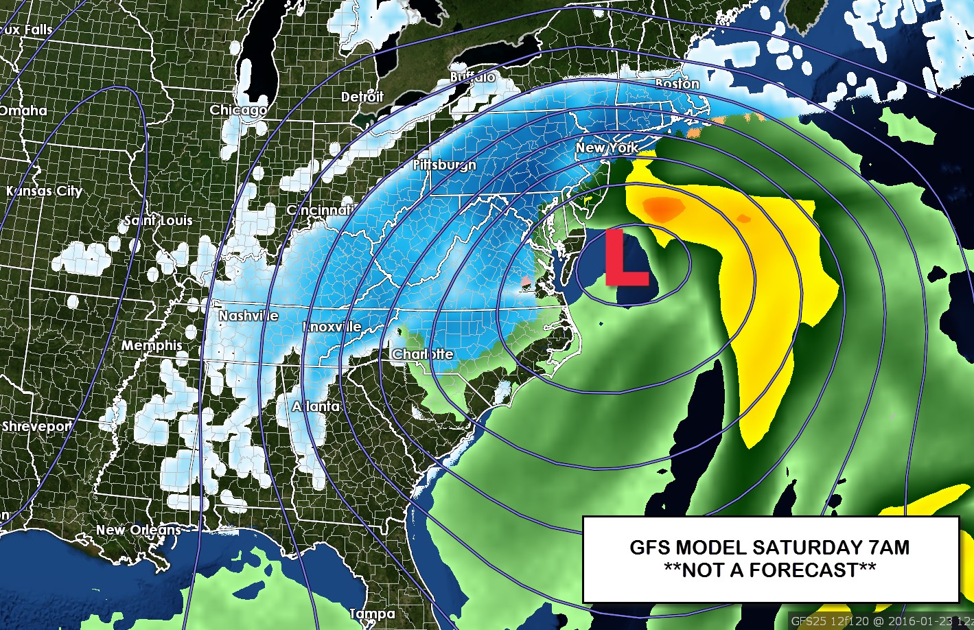
GFS Deterministic Run:
Again this is just one single run; the storm literally could be anywhere in the Mid-Atlantic or Southeast. Again I can’t stress enough that the storm could be anywhere in this region.

Brad Bottom Line:
Chill for now with detailed questions. There is going to be a storm somewhere; I wish we could tell the exact type of winter weather, how much and where. We just don’t know the science and modeling can’t resolve those details at this time range. You literally could put out a map with 0-30″ across the Mid-Atlantic right now. Stay tuned!


