Brutal cold and possibly 2 winter storms this week
Just when you thought last week was cold then comes this week. Arctic air and a blocking pattern over the northern Atlantic have set up the Carolinas for even a colder week ahead. Plus there’s the chance for not one but two winter storms that could have a major impact on the region Thursday morning then again late this weekend. With cold air in place and deep snow pack over the Midwest, Ohio and Tennessee valleys any storm system that takes a southern track could spell wintry precip problems for the piedmont of the Carolinas.
Snowpack this morning over a large section of the eastern U.S. from the visible satellite picture. 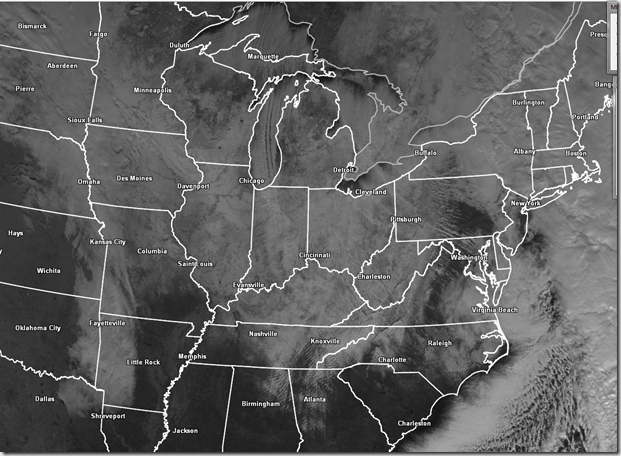
Right now about 40% of the lower 48 states in covered in snow and most of that east of the Rockies.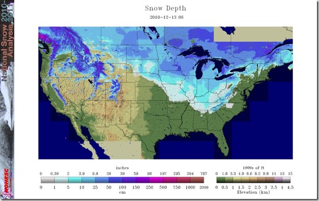
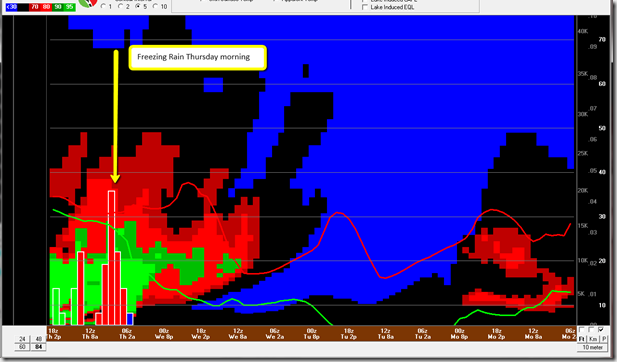
NAM Soundings for Thursday shows freezing rain in the morning. With cold air and snowpack in place it’s
likely the low levels of the atmosphere will be cold and dry causing freezing rain Thursday morning.
The GFS sounding agrees with Ice Thursday and snow possible Sunday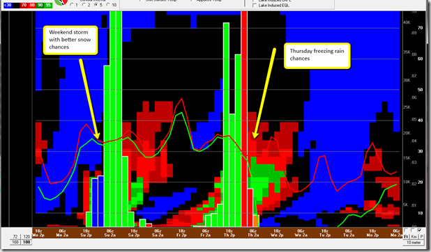
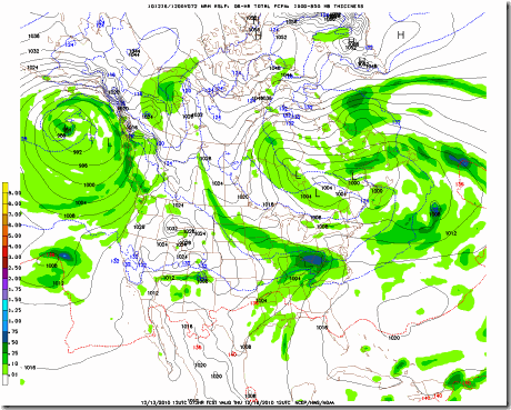
Here’s a look at the NAM notice the moisture and cold air wedge in place for some ice. The blue line in the the freezing line. Cold air the next few days will make ground temps very cold so expect this to be freezing rain or sleet.
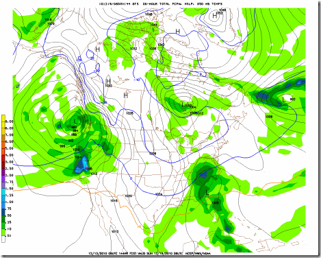
Here’s the GFS for Sundays storm cold air in place and favorable southern track of the low pressure from the Gulf of Mexico to the Carolina coast. On the northwest side of the low there should be a narrow but moderate snow chance.
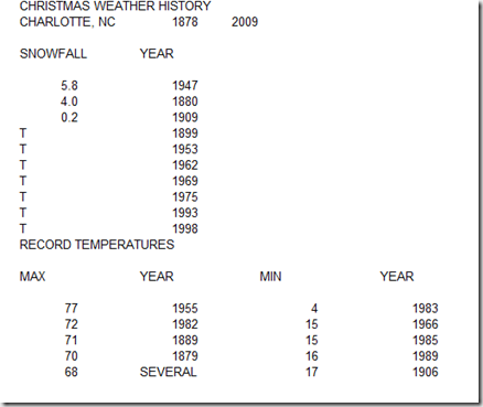
Be ready for just about anything this week with this very cold air locked in through next week. If you are wondering, the chances historically of a white Christmas in Charlotte, NC is about 2%. We’ve only had accumulating snows 3 times in 132 Christmas’s and the last time was in 1947 but Christmas 2007.
I’d put this years chances due to this pattern we are in closer to 10%.

