The Highest Point in Charlotte is a Cul-de-sac
Besides my love and passion for weather and science, I also enjoy maps and geography. So it piqued my interest when I came across a recent story in Charlotte Magazine about how Uptown Charlotte got its name. When most people call their center city “downtown” Charlotte calls it “Uptown”. The basic reason wasn’t a PR stunt but has historical roots based on the elevation of center city. The geographic center of Charlotte is the intersection of Trade and Tryon at 746’ above sea level. This elevation makes it much higher than the surrounding neighborhoods and most of Charlotte. Thus making you have to literally travel uphill to get to center city. So thus the name Uptown Charlotte.
Well this got me thinking; clearly 764’ wasn’t the highest point in Charlotte or even Mecklenburg County. Turns out it isn’t and there is part of Charlotte that’s still sees Uptown as Downtown based on elevation. Now I had heard rumors that the highest point is Charlotte was the club house at Cedarwood Country Club. I even heard it was a hill at Charles T Myers golf course. Which by the way was built on Charlotte’s first landfill. Turns out both were wrong, I had to look up the elevations on a topographical map. The problem there was none of the maps had a definitive peak so the elevation contours weren’t much help. The maps did make me narrow it down to Northeast Charlotte towards the University area which everyone knows is very hilly.
I was eventually able to find the highest point in every county in the state using the North Carolina Geologic Survey. They listed the highest point in Mecklenburg County as follows.
Mecklenburg: point 1 mile east of Brockenbrough Airport 890’+Derita
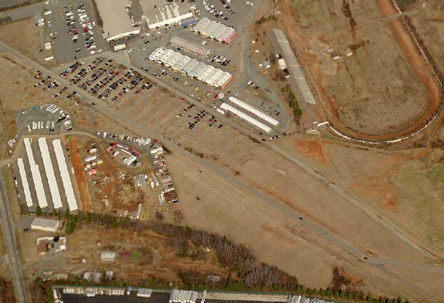
Well small problem there is no longer any Brockenbrough Airport, but at least I know where Derita is. A little more research revealed that the Brockenbrough Airport is a little known abandoned airfield. There is one runway which is still there next to the Metrolina Fairgrounds and race track. It’s not an airport anymore but you can tell it was from the aerial picture below. Noticed the paved over runway which runs parallel to Fairground Road.

So now I head 1 mile east of this old airfield and I should be at the highest point in Charlotte. Using Google Earth I pinpointed the exact location at or near Emma Lynn Court. Which you can see below and also see how much higher it is compared to “Uptown”. (I also should note Apples new Maps app can’t find this place either)
So what’s does this high point look like? Is there some marker or designation? Clearly it has some name like Derita Hill, Mount Charlotte, Mecklenburg Peak…right?
Nope this is all there is… a cul-de-sac.
Standing in the middle of the the cul-de-sac my GPS read 885’. Just shy of the 890’ stated in the Geological Survey map, but looking past this fence & into this back yard(picture left below) it looks a bit higher and likely 890’. I wasn’t walking into some persons yard so take my word for it.
Now doing further research reveals that this area does have some names that might apply to these hills. In fact the street names seem to reflect the topography of the area very well. There are names like Grays Ridge Drive and Christenbury Hills Lane but no specific name for this hill.
So what do you think should this point have a name? Let me know in the comments sections below and by the way I added this location into Foursquare so you can check-in here. ![]()


