Top Ten Weather Events of 2010 for the Charlotte Region
#10 La Nina Drought conditions
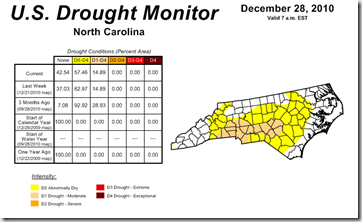
At the peak of our moderate drought 72.6% of the state was under moderate drought conditions. Even at the end of the year most of the piedmont is still under moderate drought.
#9 July Heat Wave #1 & #2
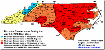
July 6-8, 2010 most of the state had the first of 2 extreme heat waves. The worst of the heat was in the eastern part of the state but Charlotte set a record high of 101° on July 8th.
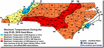
This heat wave was July 23-25, 2010 and had a larger impact in the piedmont and upstate of SC. This included a record high of 101° in Charlotte on July 25th.
#8 Light December Ice
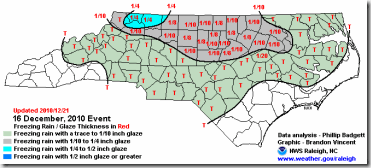
This was an example of how a very cold ground with a very light freezing rain can have a large impact on the region. Almost every school was delayed or closed, except CMS. This became a minor controversy with the new delay policy that wasn’t used during this event.
#7 Late September-Early October Nor’easter
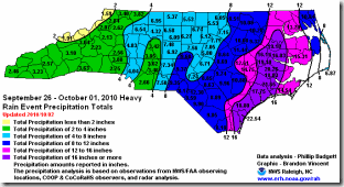
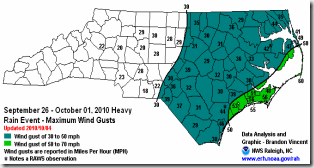
The combination of rain and wind with a stalled front & Nor’easter brought loads of rain for the entire state. With higher amounts and high winds at the coast.
#6 January Winter Storm
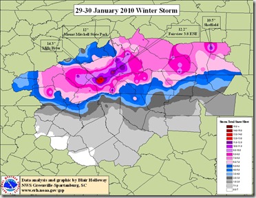
This was one of several storms that blanketed the Carolinas but seemed to just barely drop snow in Charlotte. Totals from 6-12” fell across the I-40 corridor. In Mecklenburg Co. 6” fell in Huntersville but only about 1-2” fell in and around Uptown Charlotte and points south. Seemed like every storm went north or even south of Charlotte. ![]()
#5 Palm Sunday Tornado Outbreak
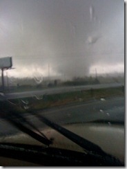
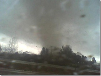
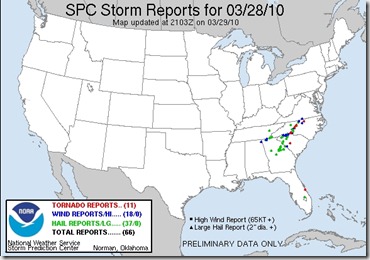
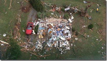
This was a very active tornado day in the Carolinas. Two tornadoes touched down in our area one near Belmont. With another very well photographed tornado near Spencer in Rowan Co. The Spencer tornado was captured by several motorists as it crossed over as it I-85. (photos above)
#4 Vale Tornado October 26, 2010
A very strong tornado struck Vale as well as parts of Catawba Co. The damage was rated as EF-2 with border line EF-3 damage with winds estimated near 125mph. This was one tornado that was part of tone of the largest 2 day tornado outbreaks in a many years in the Carolinas. In total 12 tornadoes touched down on October 26-27, 2010. More information from my previous blog post.
#3 Early and Late Cold
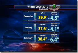
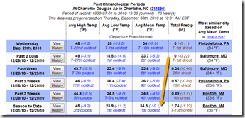
The year started with the coldest winter since the 1970s as January saw a week where we barely got above freezing for 6 straight days. It had been 2 generations since we had seen cold like this in the region. Then in December we had the coldest December in over 72 years. This December will go down as either the 2nd or third coldest on record once the final numbers come in at the end of the month.
#2 Mountain snow and ice that never ended.
Between the snow of last winter and the snow of this December. the mountains have had some of the coldest and snowiest weather in over 32 years. Already this winter just one month in Beech mountain has almost reached it’s average annual snowfall. The school districts of Avery, Ashe & Watauga counties have been closed 10 days already this winter. Last year they lost almost an entire month to snow days!
#1 First White Christmas in 63 years
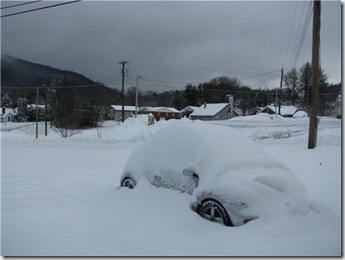
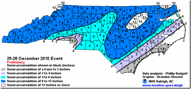
While this is the freshest in our memories it’s also by far and away the most amazing and memorable event of the whole year. It is extremely rare to get snow on Christmas day, this is just the 4th time it’s ever happened in 132 years of records in Charlotte. Many locations like Colombia, SC saw their first white Christmas ever. Most of the snow fell in the mountains and foothills Christmas day, but the rest fell Christmas night and the day after for much of the the rest of the state. The chances of a white Christmas in Charlotte are just 2%, making this statistically a once in a lifetime event.
These are just my top ten what are your? Please fell free to post your feed back and opinions in the comment section. Or via Twitter or Facebook.

![vale_4panel[4] vale_4panel[4]](https://lh4.ggpht.com/_MXuXl8WY3yg/TRy7V0S8w_I/AAAAAAAAAxM/Deo0UrHAkf0/vale_4panel%5B4%5D_thumb%5B1%5D.png?imgmax=800)
