
What is Graupel?
With many reports of graupel today and sometimes misidentified with snow I thought I’d share what exactly it is. It’s a form of precipitation that isn’t seen very often even though it’s present in almost every thunderstorm or thundershower. Graupel is often referred to also as a soft hail, snow grains or snow pellets. It forms when you have some warmer air at the surface and very cold air aloft. Usually you get this when we have strong upper level lows and just chilly enough air at the surface to allow the graupel to reach the ground. Pretty much exactly the type of set-up we have today. You can also get this mixed in with thunder-snow like we had back in February.
The Official definition is as follows:
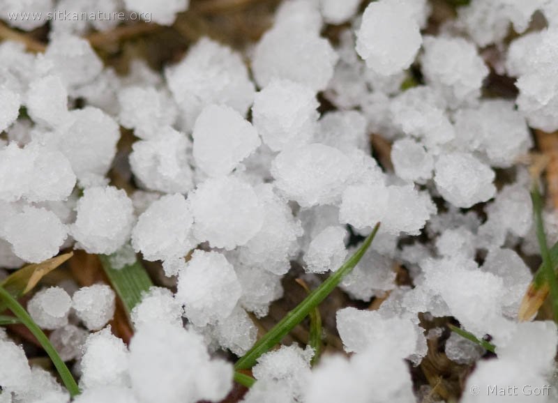
Definition: Graupel forms when snow in the atmosphere encounters super cooled water. In a process known as accretion, ice crystals form instantly on the outside of the snow and accumulate until the original snowflake is no longer visible or distinguishable.
The coating of these ice crystals on the outside of the snow is called a rime coating. The size of graupel is typically under 5 millimeters, but some graupel can be the size of a quarter (coin).
To tell the difference between graupel and hail, you simply have to touch a graupel ball. Graupel pellets typically fall apart when touched or when they hit the ground. Hail is formed when layers of ice accumulate and are very hard as a result.
Also Known As: snow pellets, soft hail, small hail, tapioca snow, rimed snow, ice balls
How can you tell when you has it here’s a quick visual guide to the appearance.


