
Winter Storm Potential Going Up: Tuesday-Thursday
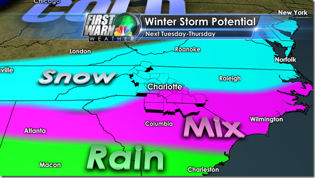
Well the trends are becoming clear we are going to see some kind of a winter storm the question is what type? By type I mean either ice, snow, sleet or rain and in what combination of 2 or 3? The biggest issue now isn’t if the storm comes but how much of it comes and and in what form. This is a Meteorological headache that a gigantic Excedrin won’t cure! The problem is the potential for large amounts of moisture or QPF over a prolong period of time. It will be flooding into a shallow or deep cold air mass, again this is in question as well. This could all have huge impacts on travel, schools and even power.
Needless to say I don’t have specific amounts but it may not matter because the impacts could be the same. I’m leaning towards a wintry mix of rain changing to snow on Tuesday afternoon into the evening. Then possibly changing to ice on Wednesday into Thursday. All of that subject to big time changes. Sorry it just is right now
So here’s what I have right now.
The SREF is trending up to almost 2” of snow by 7pm. This is the average or mean of 21 members of the Short range GFS.

The ECMWF Ensembles are even wetter and colder. With high chances of 3” or more. If you hear or see specifics ECMWF snowfall totals ignore them. The output is all frozen precip and is the combined snow, sleet and freezing rain together with a 10:1 liquid conversion. Basically meaning they are always inflated, but even if you half them it’s a huge amount of frozen precipitation.

My thinking right now:

No matter what, be ready for winter weather!

Where the snow meter is at right now, but it is trending up!
")
Stay tuned to wcnc.com NBC Charlotte and my Facebook, Twitter and Google + pages for updates 24hrs a day.


