
Winter Storm On The Way
The ingredients are coming together for a significant winter storm for a large part of the Carolinas including the Charlotte metro area.
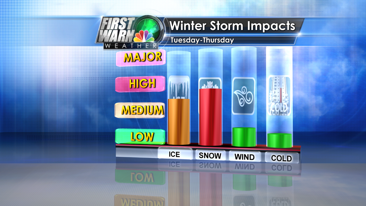
Not going to lie the forecast is extremely difficult. Not because it may or may not happen either. I can guarantee you a winter storm is going to hit the Carolinas.The problem is how much and what types of winter precipitation?
So knowing that, here is what I’m thinking right now as of 2pm Sunday, and this could change by tonight. Stay tuned!
2-4″ of snow and Sleet for a large section of our viewing area.
0.10″ to 0.25″ of ice especially the further South you go.
Significant travel impacts starting Tuesday lasting into Thursday.


Here’s a look at the general idea of timing of the storm system. Remember the mix area is snow, ice or sleet mixed with rain.
Tuesday morning:

Tuesday night into Wednesday:

Wednesday night into Thursday:

What could change?:
Slight changes in the track intensity or amount of cold air will have huge changes to the impacts. More warm air aloft means more ice and maybe lots of ice. If it’s all ice it would cause major power disruptions.
If it’s colder and all snow you are talking about 4-8″ of snow .
If it’s more rain than any snow that fall early melts, and we just have cold miserable weather. Even in this scenario we get some sleet and snow but it melts quickly once the rain starts.

Snow Meter is now raised to a 5:

Stay tuned to the weather and be prepared.
No matter what happen we wills see some impacts it;s always better to be prepared ahead of time. Rather than try and make last minute preparations in the middle of a winter storm.
Stay tuned to the First Warn Storm Team. Grab our WeatherCaster App, Follow me on Facebook, Twitter and Google +.


