
Historic Flood potential in the Western Carolina’s.
I hate it when people exaggerate a weather threat as much as the next person. In this case, you really wouldn’t be wrong is using any method you can find to get people to listen to the potential threat. There are very few times in a Meteorologists career where these many elements in the atmosphere align for an extreme event like this. So lets put this all perfect to understand how rare this threat is.
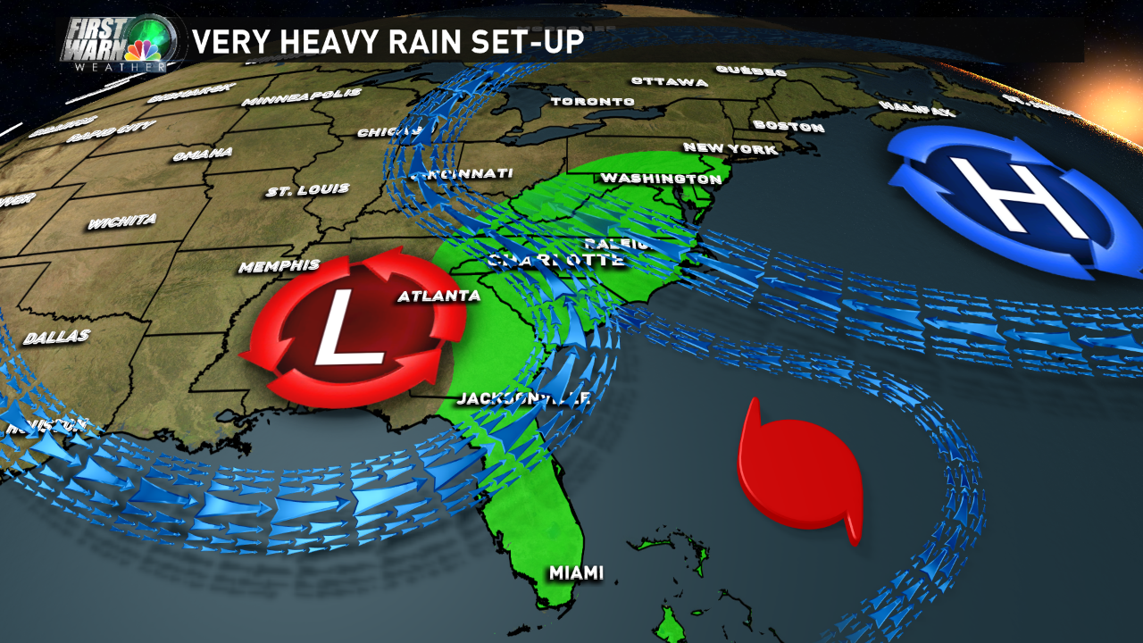
The Set-up:
There are literally 3 fire hoses in the atmosphere pumping moisture into the Carolinas over the next 72 hrs. Moisture is coming from the Pacific, the Gulf of Mexico and the Atlantic. Heck this is with hurricane Joaquin staying offshore too.
The amounts of moisture in the atmosphere flowing in over the next 3 days is about 200-300% above normal.

How much Rain?
My forecast right now:

The EURO Model:

The RPM Model:

How does this compare to the record books?
These are the 3 day rainfall records for a few select cities. In just about every case this event could rival or break these records.


